UN
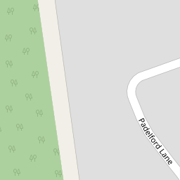
9 Padelford Lane
£ 910,000
Description
We don't have a Description for this property.
- Bedrooms
- 4
- Bathrooms
- 0


Leaflet © OpenStreetMap contributors
The heatmap indicates the level of crime in the area. The color of the heatmap indicates the crime severity and recency.
Metrics Year-on-Year
- Average area value
- 623,952.00 £Decreased by 17.13 %
- Average area rental value
- 2,389.00 £/moIncreased by 8.44 %
- Est rental Yield
- 4.59 %Increased by 30.77 %
- Crime Rate
- 12.00 %Unchanged by 0.00 %
from 752,973.00 £
from 2,203.00 £/mo
from 3.51 %
from 12.00 %
Nearby Schools
| Name | Type | Ofsted | Distance |
|---|---|---|---|
| St John'S Cofe School | Voluntary Aided School | Good | 1.26 KM |
| Immanuel College | Other Independent School | 1.66 KM | |
| Avanti House Primary School | Free Schools | Good | 1.81 KM |
| Stanmore Park | Children's Centre Linked Site | 1.92 KM | |
| Bentley Wood High School | Academy Converter | Outstanding | 1.93 KM |
Images
Nearby Streets
| Name | Average Price | Average Sqft | Distance |
|---|---|---|---|
| Priory Close | £ 2,500,000 | 0 | 0.00 KM |
| Elizabeth Grove | £ 1,923,333 | 0 | 0.00 KM |
| Montacute Road | £ 0 | 0 | 0.00 KM |
| Holland Close | £ 1,416,667 | 0 | 0.00 KM |
| The Briars | £ 0 | 0 | 0.00 KM |
Nearby Transport
| Name | NLC | TLC | Distance |
|---|---|---|---|
| Harrow And Wealdstone | 1397 | HRW | 4.60 KM |
| Headstone Lane | 1434 | HDL | 5.01 KM |
| Elstree And Borehamwood | 1542 | ELS | 5.27 KM |
| Kenton | 1399 | KNT | 5.59 KM |
| Hatch End | 1398 | HTE | 5.66 KM |
Nearby Listings
| Address | Price | Type | Score | Distance |
|---|---|---|---|---|
| Brightwen Grove, Stanmore, HA7 | £ 900,000 | BUY | 8 / 10 | 0.13 KM |
| Capel Crescent, STANMORE, HA7 | £ 625,000 | BUY | 6 / 10 | 0.13 KM |
| Casel Court, Stanmore, HA7 | £ 450,000 | BUY | 5 / 10 | 0.19 KM |
| Brightwen Grove, Casel Court, HA7 | £ 400,000 | BUY | 5 / 10 | 0.20 KM |
| Capel Crescent, Stanmore, Middlesex | £ 270,000 | BUY | Unknown | 0.24 KM |
Nearby Properties
| Address | Price | Distance |
|---|---|---|
| 29 Padelford Lane | £ 999,950 | 0.00 KM |
| 13 Padelford Lane | £ 638,000 | 0.00 KM |
| 10 Padelford Lane | £ 770,000 | 0.00 KM |
| 4 Padelford Lane | £ 725,000 | 0.00 KM |
| 15 Padelford Lane | £ 770,000 | 0.00 KM |